


SwitzerlandMobility app for iPhone and iPad
Developer: Stiftung SchweizMobil
First release : 22 May 2012
App size: 82.62 Mb
The free SwitzerlandMobility app (for iPhone and iPad) is the perfect app for anybody who is out and about in Switzerland either in summer or winter..
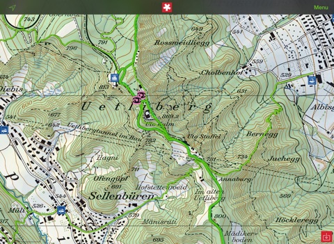
- maps of Switzerland from swisstopo (the best) up to a scale of 1:10,000
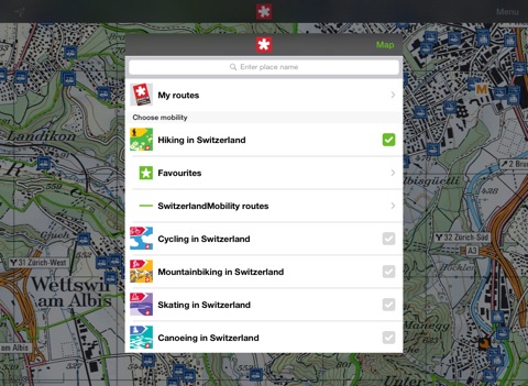
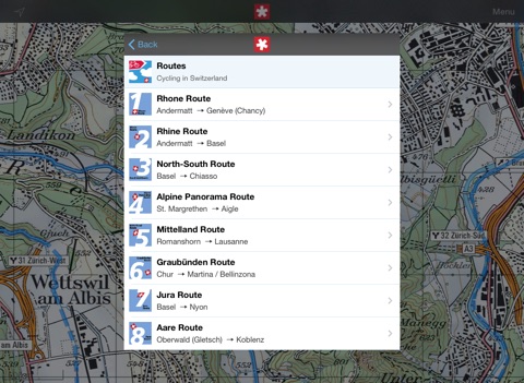
- 32,000 km signposted non-motorized routes (national, regional and local)
- complete network of signposted hiking trails (60,000 km)
- 600 routes for winter activities
- 25,000 public transportation stops linked to the timetable of the Swiss Federal Railways (planning a tour with public transportation was never easier)
- information on 4,500 points of interest on the way, such as overnight accommodations, bicycle service stations, etc.
- positioning system and compass function (you always know where you are)
- map orientation (the map turns and moves in viewing direction)
On purchasing a SwitzerlandMobility Plus subscription you can additionally:
- use and save swisstopo maps for areas without network coverage (no more problems with dead zones)
- Recording tours (GPS tracking)
- download and store tours you designed, including elevation profile, hiking time, distance and altitudes (separately and easily)
Technical information
- iPhone: requires iOS 10 or later.
- iPad: requires iOS 10 or later.
- The app requires network coverage (useable without network coverage with SwitzerlandMobility Plus).
- Constant use of the GPS may considerably reduce the length of battery life.