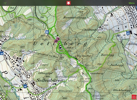
The SwitzerlandMobility app is the perfect companion for anyone who likes to be outdoors, whether in summer or winter.
Discover new routes, be inspired, and plan and navigate your experiences.
DISCOVER THE MOST ATTRACTIVE ROUTES IN SWITZERLAND
The SwitzerlandMobility app offers access to the 1,500 most enticing routes in Switzerland and the Principality of Liechtenstein. In summer, the range includes hiking, cycling, mountain biking, skating and canoeing. In winter, you will find a wide selection of winter hiking trails, snowshoe routes, cross-country ski trails and toboggan runs. The route network is available to you in the highest map quality with national maps from swisstopo, up to a scale of 1:10,000.
SIMPLE PLANNING OF TOURS
You will find thorough descriptions and detailed photo reports for each route. This gives you a good idea of what to expect at the site. The public transport stops, including the next departure times with a direct link to the SBB app as well as a wealth of additional information on accommodation options, sights, stopover locations, bike rental and bike service stations make it easy to prepare your trip.
TRAVELLING SAFELY
The SwitzerlandMobility routes are official and are signposted locally. Current route closures and diversions are also available in the app. The information is updated daily, so you have the latest details at all times.
LOCATION TRACKING AND COMPASS FEATURE
You can always find the right trail with the SwitzerlandMobility app. You can easily see where you are on the map with location tracking. The compass feature aligns the map in the direction you are looking so that you can follow your planned tour.
PLAN YOUR OWN TOURS
Plan your own tours on the swisstopo map. The distance, ascents and descents, altitude profile and time required are calculated automatically. This feature is available to you with SwitzerlandMobility Plus (charges apply).
USE THE APP WITHOUT NETWORK RECEPTION
Planned tours, map sections and all route information are available offline in the app. This is ideal for alpine terrain where there is no network reception. Save any map section with the content you choose. This feature is available to you with SwitzerlandMobility Plus (charges apply).
RECORD YOUR OWN TOURS IN THE APP
With SwitzerlandMobility Plus you can have your tour automatically recorded in the app. This gives you an overview of all important information such as distance, altitude covered and time required. This feature is also available to you with SwitzerlandMobility Plus (charges apply).
Find out more about the advantages and additional features of SwitzerlandMobility Plus: www.switzerlandmobilty.ch/de/switzerlandmobility-plus


